BY:SpaceEyeNews.
Introduction: 3-Satellite Global Tracking Breakthrough Explained
The 3-satellite global tracking breakthrough is reshaping how Earth is observed from space. A recent demonstration tracked a massive oil tanker continuously from about 35,800 kilometers above Earth. That detail stands out. Yet the real shift lies in the system behind it.
Instead of large constellations, researchers suggest that only three satellites could deliver near-continuous global coverage. This approach challenges long-held assumptions about satellite design. It also points toward a future of more efficient and persistent observation from orbit.
What the 3-Satellite Global Tracking Breakthrough Demonstrated
Tracking a 340-Meter Vessel from Geostationary Orbit
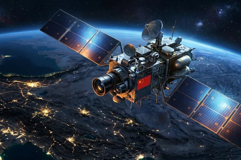
The 3-satellite global tracking breakthrough builds on a real-world test involving a large vessel. The Towa Maru, about 340 meters long and 60 meters wide, was tracked while moving across open waters.
Observation came from a satellite positioned at roughly 35,800 kilometers above Earth in geostationary orbit. At this altitude, satellites remain fixed relative to the surface. This enables constant monitoring of the same region.
Tracking a moving object from such a distance is demanding. Signals weaken over long ranges. Minor distortions can affect precision. Even so, the system maintained stable tracking.
From Periodic Imaging to Continuous Observation
Traditional systems rely on satellites in low Earth orbit. These satellites pass over a location, collect data, and move on. This creates gaps between observations.
The 3-satellite global tracking breakthrough changes that model. Instead of isolated snapshots, the system enables continuous tracking. The result is a steady stream of data rather than separate images.
Continuous observation reveals movement patterns over time. It also improves visibility across oceans and remote regions.
How the 3-Satellite Global Tracking Breakthrough Works
Why Geostationary Orbit Enables Constant Coverage
The 3-satellite global tracking breakthrough depends on geostationary orbit. At around 35,800 kilometers, a satellite can observe a large portion of Earth without interruption.
Because the satellite remains fixed relative to the surface, it removes observation gaps. Each satellite maintains a constant view of its assigned region.
Synthetic Aperture Radar Makes It Possible
A key component is Synthetic Aperture Radar (SAR). This radar system actively scans the surface and analyzes reflected signals.
SAR offers clear advantages:
- It works day and night
- It is not affected by clouds or storms
- It maintains consistent observation quality
Operating SAR from geostationary orbit is complex. Signals travel long distances and require advanced processing. The successful demonstration highlights progress in signal handling and data accuracy.
Why Only Three Satellites Are Needed
The most striking feature of the 3-satellite global tracking breakthrough is the limited number of satellites.
Each geostationary satellite covers a wide area. When three satellites are placed at evenly spaced positions around Earth, their coverage zones overlap.
This creates near-global visibility with continuous monitoring. It reduces the need for large satellite constellations.
Comparing Traditional Systems with the 3-Satellite Global Tracking Breakthrough
Low Earth Orbit vs High Orbit Systems
Most current observation systems rely on low Earth orbit satellites. These satellites move quickly and observe regions in short intervals.
The 3-satellite global tracking breakthrough uses a different approach. Fewer satellites remain fixed in geostationary orbit, delivering constant coverage.
Efficiency in Satellite System Design
This model focuses on capability rather than quantity. Fewer satellites can simplify deployment and reduce operational complexity.
At the same time, each satellite must handle more advanced tasks. This includes signal processing and continuous data flow.
Resolution and Coverage Balance
High-altitude systems may not match the resolution of low Earth orbit satellites. Detailed imaging often requires closer proximity.
A combined approach offers balance. Geostationary satellites provide continuous tracking, while lower orbit satellites supply detailed imagery.
Global Impact of the 3-Satellite Global Tracking Breakthrough
Continuous Global Observation
The 3-satellite global tracking breakthrough introduces continuous global observation. Instead of periodic imaging, systems can track movement in real time.
This improves understanding of patterns and changes across large areas.
Reliable Monitoring in All Conditions
Radar systems operate regardless of weather or lighting. This ensures consistent observation.
Cloud cover and night cycles no longer limit visibility. Data collection becomes more reliable.
A Shift Toward Persistent Awareness
The most important change is persistent awareness. Observation becomes continuous rather than occasional.
This shift influences how data is collected, analyzed, and used. It also shapes future satellite system design.
Limitations and Future Development
Early Stage Capability
The 3-satellite global tracking breakthrough remains in development. Tracking a single vessel is an important milestone, but not a complete system.
Scaling this capability will require further validation.
Technical Challenges
Several challenges remain:
- Maintaining resolution across wide areas
- Processing large volumes of data
- Managing signal interference
These factors will shape future progress.
Multi-Layer Satellite Systems
Future systems will likely combine multiple orbital layers. Geostationary satellites provide continuous coverage. Lower orbit satellites add detail.
This integrated approach balances persistence and precision.
Conclusion: Why the 3-Satellite Global Tracking Breakthrough Matters
The 3-satellite global tracking breakthrough marks a turning point in space-based observation. Continuous tracking from geostationary orbit challenges traditional satellite models.
Instead of relying on large constellations, fewer satellites may deliver broader coverage. While the system is still evolving, the concept signals a new direction for global monitoring.
As the technology advances, observation from space may become more persistent and efficient. This breakthrough highlights a shift toward continuous awareness and smarter satellite design.
Sources:
https://www.scmp.com/news/china/science/article/3349862/3-satellites-track-all-chinese-radar-images-confirm-us-military-fears
https://earth.esa.int/eogateway/missions/sentinel-1
https://www.nature.com/articles/s41598-020-64129-2