
BY:SpaceEyeNews.
Mars layered deposits in Arabia Terra display intricate patterns that resemble coral from orbit. Yet their scientific appeal goes deeper than appearance. Repeating bands could preserve clues to environmental processes that shaped the region long ago. NASA’s HiRISE camera has captured these formations in striking detail, exposing a landscape of bright layers and eroded edges. The central mystery concerns their origin: did recurring dust storms build these deposits, and did groundwater play a role? Scientists have proposed those possibilities, but the image does not settle the question.
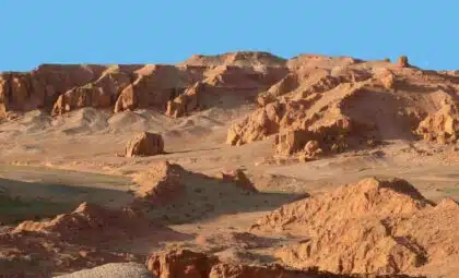
What the Mars Layered Deposits Actually Show
A detailed view of Arabia Terra
HiRISE photographed the scene on May 21, 2026, aboard NASA’s Mars Reconnaissance Orbiter. The official explanation, written by Cathy Weitz, appeared on September 21. Those dates distinguish the observation from later news coverage.
The image shows light-toned layers within a region where deposits occupy large impact craters. Similar thickness and brightness suggest that successive layers contain similar materials. However, visual similarity alone does not establish their precise composition.
A landscape with measurable scale
The spacecraft observed the terrain from an altitude of about 274 kilometers. The full black-and-white view spans approximately five kilometers, while the enhanced-color view covers about one kilometer.
The original image scale is approximately 55 centimeters per pixel. The observation details indicate that objects around 1.64 meters across are resolvable. These figures describe the image’s spatial detail; they do not measure the thickness of the geological layers. www.uahirise.org
That scale helps readers interpret the intricate scene. Features that look delicate in a cropped picture belong to a substantial landscape. Meanwhile, the wider distribution of layered deposits across Arabia Terra gives researchers a regional puzzle to investigate.
Why Repeating Layers Matter
Patterns that suggest recurring processes
The most useful clue lies in repetition. A succession of comparable layers raises questions about whether similar conditions returned during deposition. Their broad distribution also encourages scientists to consider processes that extended beyond one location.
Researchers have therefore proposed a connection to global cyclic processes. This remains an interpretation of the geological pattern, rather than a confirmed reconstruction of past events.
The distinction matters because an orderly appearance does not automatically reveal its cause. Scientists must connect the visible arrangement with a plausible history of material accumulation and later modification.
A record without a complete timeline
Layers can preserve the sequence of events without revealing how much time separated them. Here, the official image explanation provides no precise duration for individual cycles.
Consequently, these bands should not become annual markers or fixed climate intervals in the telling. Their value lies in the possibility of identifying repeated conditions. Establishing when those conditions occurred requires evidence beyond the patterns alone.
Dust Storms and the Groundwater Possibility
Could atmospheric cycles explain the deposits?
Dust storms offer one proposed explanation for the rhythmic layering. Repeated episodes of dust transport and accumulation could help account for recurring deposits across a broad region.
In this scenario, the landscape would preserve the consequences of atmospheric activity over time. However, the image does not identify individual storms or show how much material each episode contributed.
The hypothesis gives researchers a process to investigate. It does not supply a complete formation history or demonstrate that every visible band shares an identical origin.
Where groundwater might fit
Weitz’s explanation also allows for possible groundwater involvement. That possibility broadens the discussion beyond material moving through the atmosphere.
However, the source does not establish how underground water influenced this particular deposit. Nor does the photograph directly reveal a former water table.
Careful wording keeps the story compelling without overstating the evidence. Groundwater may belong in the explanation, but researchers have not confirmed its role here. Likewise, the coral-like appearance provides no basis for describing the terrain as an ancient reef.
How Erosion Sculpted the Landscape
The layers and their later appearance
The deposits’ present shape reflects more than their original formation. Erosion has produced pits, irregular outlines, and jagged edges across the exposed material.
This creates two connected questions. What built the layers, and what subsequently sculpted them? Treating those questions separately prevents today’s surface textures from becoming automatic evidence of the original environment.
The striking patterns therefore combine a depositional history with later surface modification. Their visual complexity reflects that overlapping sequence.
Darker material adds another chapter
Wind-blown ripples and debris have more recently covered and filled parts of the layered terrain. These darker accumulations add another stage to the landscape’s history.
Some details expose older material, while other areas conceal it beneath newer deposits. As a result, researchers must consider both removal and accumulation when interpreting the scene.
The image captures this relationship in one view: ancient deposits retain recognizable layers, even as later processes alter their exposed surfaces.
What HiRISE Can—and Cannot—Reveal
Detailed structure, unresolved origins
HiRISE gives scientists detailed views of surface structure. NASA describes its high-resolution imaging as a way to investigate Martian terrain far more closely than broad orbital views allow. science.nasa.gov
Nevertheless, a photograph is not a complete environmental record. It cannot independently determine every material, date each layer, or establish the full chain of processes responsible.
The key unanswered questions concern composition, timing, and formation conditions. Comparing the layers’ physical properties could help assess proposed explanations. Any interpretation must also account for their regional extent and subsequent erosion. Keeping those gaps visible strengthens the explanation. Readers can understand why the formations matter without mistaking a promising hypothesis for a settled discovery.
Mars Layered Deposits Preserve an Unfinished Story
Mars layered deposits in Arabia Terra offer a striking opportunity to examine the planet’s environmental past. Repetition suggests processes worth investigating, while erosion reveals and reshapes the surviving record. Dust storms and groundwater remain possible parts of that history. The challenge now lies in connecting the visible patterns to their causes. For readers, the most compelling detail is also the simplest: these unusual formations preserve clues, but scientists are still working out how to read them.
Main sources:
HiRISE, University of Arizona — Rhythmic Layering in Arabia Terra:
https://www.uahirise.org/ESP_092890_1825
NASA — Mars Reconnaissance Orbiter Science Instruments:
https://science.nasa.gov/mission/mars-reconnaissance-orbiter/science-instruments/